

In recent years, aerial object detection has been increasingly pivotal in various earth observation applications. However, current algorithms are limited to detecting a set of pre-defined object categories, demanding sufficient annotated training samples, and fail to detect novel object categories. In this paper, we put forth a novel formulation of the aerial object detection problem, namely open-vocabulary aerial object detection (OVAD), which can detect objects beyond training categories without costly collecting new labeled data. We propose CastDet, a CLIP-activated student-teacher detection framework that serves as the first OVAD detector specifically designed for the challenging aerial scenario, where objects often exhibit weak appearance features and arbitrary orientations. Our framework integrates a robust localization teacher along with several box selection strategies to generate high-quality proposals for novel objects. Additionally, the RemoteCLIP model is adopted as an omniscient teacher, which provides rich knowledge to enhance classification capabilities for novel categories. A dynamic label queue is devised to maintain high-quality pseudo-labels during training. By doing so, the proposed CastDet boosts not only novel object proposals but also classification. Furthermore, we extend our approach from horizontal OVAD to oriented OVAD with tailored algorithm designs to effectively manage bounding box representation and pseudo-label generation. Extensive experiments for both tasks on multiple existing aerial object detection datasets demonstrate the effectiveness of our approach. The code is available at //github.com/lizzy8587/CastDet.
相關內容
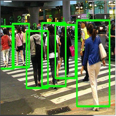
目(mu)標(biao)(biao)檢(jian)測(ce)(ce),也叫目(mu)標(biao)(biao)提取,是一種與計(ji)(ji)算機(ji)視(shi)(shi)覺和圖(tu)像處理有關的計(ji)(ji)算機(ji)技術,用于檢(jian)測(ce)(ce)數字(zi)圖(tu)像和視(shi)(shi)頻中特定類(lei)別的語義對象(例(li)如人(ren),建筑物或汽(qi)車)的實例(li)。深(shen)入研究的對象檢(jian)測(ce)(ce)領域(yu)包括面部(bu)檢(jian)測(ce)(ce)和行人(ren)檢(jian)測(ce)(ce)。 對象檢(jian)測(ce)(ce)在計(ji)(ji)算機(ji)視(shi)(shi)覺的許多領域(yu)都有應(ying)用,包括圖(tu)像檢(jian)索和視(shi)(shi)頻監視(shi)(shi)。
In real-world applications of mobile robots, collision avoidance is of critical importance. Typically, global motion planning in constrained environments is addressed through high-level control schemes. However, additionally integrating local collision avoidance into robot motion control offers significant advantages. For instance, it reduces the reliance on heuristics and conservatism that can arise from a two-stage approach separating local collision avoidance and control. Moreover, using model predictive control (MPC), a robot's full potential can be harnessed by considering jointly local collision avoidance, the robot's dynamics, and actuation constraints. In this context, the present paper focuses on obstacle avoidance for wheeled mobile robots, where both the robot's and obstacles' occupied volumes are modeled as ellipsoids. To this end, a computationally efficient overlap test, that works for arbitrary ellipsoids, is conducted and novelly integrated into the MPC framework. We propose a particularly efficient implementation tailored to robots moving in the plane. The functionality of the proposed obstacle-avoiding MPC is demonstrated for two exemplary types of kinematics by means of simulations. A hardware experiment using a real-world wheeled mobile robot shows transferability to reality and real-time applicability. The general computational approach to ellipsoidal obstacle avoidance can also be applied to other robotic systems and vehicles as well as three-dimensional scenarios.
The rapid growth of earth observation systems calls for a scalable approach to interpolate remote-sensing observations. These methods in principle, should acquire more information about the observed field as data grows. Gaussian processes (GPs) are candidate model choices for interpolation. However, due to their poor scalability, they usually rely on inducing points for inference, which restricts their expressivity. Moreover, commonly imposed assumptions such as stationarity prevents them from capturing complex patterns in the data. While deep GPs can overcome this issue, training and making inference with them are difficult, again requiring crude approximations via inducing points. In this work, we instead approach the problem through Bayesian deep learning, where spatiotemporal fields are represented by deep neural networks, whose layers share the inductive bias of stationary GPs on the plane/sphere via random feature expansions. This allows one to (1) capture high frequency patterns in the data, and (2) use mini-batched gradient descent for large scale training. We experiment on various remote sensing data at local/global scales, showing that our approach produce competitive or superior results to existing methods, with well-calibrated uncertainties.
Volumetric Mapping with Panoptic Refinement via Kernel Density Estimation for Mobile Robots
Reconstructing three-dimensional (3D) scenes with semantic understanding is vital in many robotic applications. Robots need to identify which objects, along with their positions and shapes, to manipulate them precisely with given tasks. Mobile robots, especially, usually use lightweight networks to segment objects on RGB images and then localize them via depth maps; however, they often encounter out-of-distribution scenarios where masks over-cover the objects. In this paper, we address the problem of panoptic segmentation quality in 3D scene reconstruction by refining segmentation errors using non-parametric statistical methods. To enhance mask precision, we map the predicted masks into a depth frame to estimate their distribution via kernel densities. The outliers in depth perception are then rejected without the need for additional parameters in an adaptive manner to out-of-distribution scenarios, followed by 3D reconstruction using projective signed distance functions (SDFs). We validate our method on a synthetic dataset, which shows improvements in both quantitative and qualitative results for panoptic mapping. Through real-world testing, the results furthermore show our method's capability to be deployed on a real-robot system. Our source code is available at: //github.com/mkhangg/refined panoptic mapping.
With the continuous advancement of processors, modern micro-architecture designs have become increasingly complex. The vast design space presents significant challenges for human designers, making design space exploration (DSE) algorithms a significant tool for $\mu$-arch design. In recent years, efforts have been made in the development of DSE algorithms, and promising results have been achieved. However, the existing DSE algorithms, e.g., Bayesian Optimization and ensemble learning, suffer from poor interpretability, hindering designers' understanding of the decision-making process. To address this limitation, we propose utilizing Fuzzy Neural Networks to induce and summarize knowledge and insights from the DSE process, enhancing interpretability and controllability. Furthermore, to improve efficiency, we introduce a multi-fidelity reinforcement learning approach, which primarily conducts exploration using cheap but less precise data, thereby substantially diminishing the reliance on costly data. Experimental results show that our method achieves excellent results with a very limited sample budget and successfully surpasses the current state-of-the-art. Our DSE framework is open-sourced and available at //github.com/fanhanwei/FNN\_MFRL\_ArchDSE/\ .
6D Object pose estimation is a fundamental component in robotics enabling efficient interaction with the environment. It is particularly challenging in bin-picking applications, where objects may be textureless and in difficult poses, and occlusion between objects of the same type may cause confusion even in well-trained models. We propose a novel method of hard example synthesis that is model-agnostic, using existing simulators and the modeling of pose error in both the camera-to-object viewsphere and occlusion space. Through evaluation of the model performance with respect to the distribution of object poses and occlusions, we discover regions of high error and generate realistic training samples to specifically target these regions. With our training approach, we demonstrate an improvement in correct detection rate of up to 20% across several ROBI-dataset objects using state-of-the-art pose estimation models.
The Fussell-Vesely Importance (FV) reflects the potential impact of a basic event on system failure, and is crucial for ensuring system reliability. However, traditional methods for calculating FV importance are complex and time-consuming, requiring the construction of fault trees and the calculation of minimal cut set. To address these limitations, this study proposes a hybrid real-time framework to evaluate the FV importance of basic events. Our framework combines expert knowledge with a data-driven model. First, we use Interpretive Structural Modeling (ISM) to build a virtual fault tree that captures the relationships between basic events. Unlike traditional fault trees, which include intermediate events, our virtual fault tree consists solely of basic events, reducing its complexity and space requirements. Additionally, our virtual fault tree considers the dependencies between basic events rather than assuming their independence, as is typically done in traditional fault trees. We then feed both the event relationships and relevant data into a graph neural network (GNN). This approach enables a rapid, data-driven calculation of FV importance, significantly reducing processing time and quickly identifying critical events, thus providing robust decision support for risk control. Results demonstrate that our model performs well in terms of MSE, RMSE, MAE, and R2, reducing computational energy consumption and offering real-time, risk-informed decision support for complex systems.
In this paper, we present an advanced strategy for the coordinated control of a multi-agent aerospace system, utilizing Deep Neural Networks (DNNs) within a reinforcement learning framework. Our approach centers on optimizing autonomous task assignment to enhance the system's operational efficiency in object relocation tasks, framed as an aerospace-oriented pick-and-place scenario. By modeling this coordination challenge within a MuJoCo environment, we employ a deep reinforcement learning algorithm to train a DNN-based policy to maximize task completion rates across the multi-agent system. The objective function is explicitly designed to maximize effective object transfer rates, leveraging neural network capabilities to handle complex state and action spaces in high-dimensional aerospace environments. Through extensive simulation, we benchmark the proposed method against a heuristic combinatorial approach rooted in game-theoretic principles, demonstrating a marked performance improvement, with the trained policy achieving up to 16\% higher task efficiency. Experimental validation is conducted on a multi-agent hardware setup to substantiate the efficacy of our approach in a real-world aerospace scenario.
Detecting carried objects is one of the requirements for developing systems to reason about activities involving people and objects. We present an approach to detect carried objects from a single video frame with a novel method that incorporates features from multiple scales. Initially, a foreground mask in a video frame is segmented into multi-scale superpixels. Then the human-like regions in the segmented area are identified by matching a set of extracted features from superpixels against learned features in a codebook. A carried object probability map is generated using the complement of the matching probabilities of superpixels to human-like regions and background information. A group of superpixels with high carried object probability and strong edge support is then merged to obtain the shape of the carried object. We applied our method to two challenging datasets, and results show that our method is competitive with or better than the state-of-the-art.
Conditional Random Field and Deep Feature Learning for Hyperspectral Image Segmentation
Image segmentation is considered to be one of the critical tasks in hyperspectral remote sensing image processing. Recently, convolutional neural network (CNN) has established itself as a powerful model in segmentation and classification by demonstrating excellent performances. The use of a graphical model such as a conditional random field (CRF) contributes further in capturing contextual information and thus improving the segmentation performance. In this paper, we propose a method to segment hyperspectral images by considering both spectral and spatial information via a combined framework consisting of CNN and CRF. We use multiple spectral cubes to learn deep features using CNN, and then formulate deep CRF with CNN-based unary and pairwise potential functions to effectively extract the semantic correlations between patches consisting of three-dimensional data cubes. Effective piecewise training is applied in order to avoid the computationally expensive iterative CRF inference. Furthermore, we introduce a deep deconvolution network that improves the segmentation masks. We also introduce a new dataset and experimented our proposed method on it along with several widely adopted benchmark datasets to evaluate the effectiveness of our method. By comparing our results with those from several state-of-the-art models, we show the promising potential of our method.
Inspired by recent development of artificial satellite, remote sensing images have attracted extensive attention. Recently, noticeable progress has been made in scene classification and target detection.However, it is still not clear how to describe the remote sensing image content with accurate and concise sentences. In this paper, we investigate to describe the remote sensing images with accurate and flexible sentences. First, some annotated instructions are presented to better describe the remote sensing images considering the special characteristics of remote sensing images. Second, in order to exhaustively exploit the contents of remote sensing images, a large-scale aerial image data set is constructed for remote sensing image caption. Finally, a comprehensive review is presented on the proposed data set to fully advance the task of remote sensing caption. Extensive experiments on the proposed data set demonstrate that the content of the remote sensing image can be completely described by generating language descriptions. The data set is available at //github.com/2051/RSICD_optimal


注冊地址: 北京市海淀區羊坊店路18號2幢3層301-191