

In this paper, we present the solution of roadside LiDAR object detection using a combination of two unsupervised learning algorithms. The 3D point clouds data are firstly converted into spherical coordinates and filled into the azimuth grid matrix using a hash function. After that, the raw LiDAR data were rearranged into spatial-temporal data structures to store the information of range, azimuth, and intensity. Dynamic Mode Decomposition method is applied for decomposing the point cloud data into low-rank backgrounds and sparse foregrounds based on intensity channel pattern recognition. The Triangle Algorithm automatically finds the dividing value to separate the moving targets from static background according to range information. After intensity and range background subtraction, the foreground moving objects will be detected using a density-based detector and encoded into the state-space model for tracking. The output of the proposed model includes vehicle trajectories that can enable many mobility and safety applications. The method was validated against a commercial traffic data collection platform and demonstrated to be an efficient and reliable solution for infrastructure LiDAR object detection. In contrast to the previous methods that process directly on the scattered and discrete point clouds, the proposed method can establish the less sophisticated linear relationship of the 3D measurement data, which captures the spatial-temporal structure that we often desire.
相關內容
The development of autonomous vehicles provides an opportunity to have a complete set of camera sensors capturing the environment around the car. Thus, it is important for object detection and tracking to address new challenges, such as achieving consistent results across views of cameras. To address these challenges, this work presents a new Global Association Graph Model with Link Prediction approach to predict existing tracklets location and link detections with tracklets via cross-attention motion modeling and appearance re-identification. This approach aims at solving issues caused by inconsistent 3D object detection. Moreover, our model exploits to improve the detection accuracy of a standard 3D object detector in the nuScenes detection challenge. The experimental results on the nuScenes dataset demonstrate the benefits of the proposed method to produce SOTA performance on the existing vision-based tracking dataset.
The goal of co-salient object detection (CoSOD) is to discover salient objects that commonly appear in a query group containing two or more relevant images. Therefore, how to effectively extract inter-image correspondence is crucial for the CoSOD task. In this paper, we propose a global-and-local collaborative learning architecture, which includes a global correspondence modeling (GCM) and a local correspondence modeling (LCM) to capture comprehensive inter-image corresponding relationship among different images from the global and local perspectives. Firstly, we treat different images as different time slices and use 3D convolution to integrate all intra features intuitively, which can more fully extract the global group semantics. Secondly, we design a pairwise correlation transformation (PCT) to explore similarity correspondence between pairwise images and combine the multiple local pairwise correspondences to generate the local inter-image relationship. Thirdly, the inter-image relationships of the GCM and LCM are integrated through a global-and-local correspondence aggregation (GLA) module to explore more comprehensive inter-image collaboration cues. Finally, the intra- and inter-features are adaptively integrated by an intra-and-inter weighting fusion (AEWF) module to learn co-saliency features and predict the co-saliency map. The proposed GLNet is evaluated on three prevailing CoSOD benchmark datasets, demonstrating that our model trained on a small dataset (about 3k images) still outperforms eleven state-of-the-art competitors trained on some large datasets (about 8k-200k images).
The detection of 3D objects through a single perspective camera is a challenging issue. The anchor-free and keypoint-based models receive increasing attention recently due to their effectiveness and simplicity. However, most of these methods are vulnerable to occluded and truncated objects. In this paper, a single-stage monocular 3D object detection model is proposed. An instance-segmentation head is integrated into the model training, which allows the model to be aware of the visible shape of a target object. The detection largely avoids interference from irrelevant regions surrounding the target objects. In addition, we also reveal that the popular IoU-based evaluation metrics, which were originally designed for evaluating stereo or LiDAR-based detection methods, are insensitive to the improvement of monocular 3D object detection algorithms. A novel evaluation metric, namely average depth similarity (ADS) is proposed for the monocular 3D object detection models. Our method outperforms the baseline on both the popular and the proposed evaluation metrics while maintaining real-time efficiency.

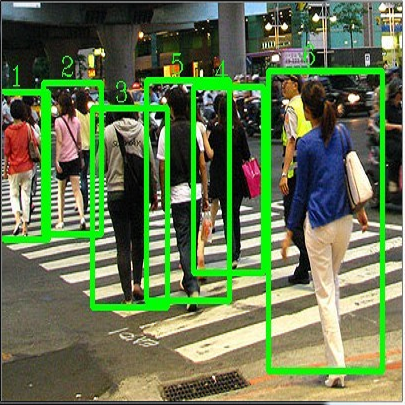
In many Asian countries with unconstrained road traffic conditions, driving violations such as not wearing helmets and triple-riding are a significant source of fatalities involving motorcycles. Identifying and penalizing such riders is vital in curbing road accidents and improving citizens' safety. With this motivation, we propose an approach for detecting, tracking, and counting motorcycle riding violations in videos taken from a vehicle-mounted dashboard camera. We employ a curriculum learning-based object detector to better tackle challenging scenarios such as occlusions. We introduce a novel trapezium-shaped object boundary representation to increase robustness and tackle the rider-motorcycle association. We also introduce an amodal regressor that generates bounding boxes for the occluded riders. Experimental results on a large-scale unconstrained driving dataset demonstrate the superiority of our approach compared to existing approaches and other ablative variants.
The past few years have witnessed an increasing interest in improving the perception performance of LiDARs on autonomous vehicles. While most of the existing works focus on developing new deep learning algorithms or model architectures, we study the problem from the physical design perspective, i.e., how different placements of multiple LiDARs influence the learning-based perception. To this end, we introduce an easy-to-compute information-theoretic surrogate metric to quantitatively and fast evaluate LiDAR placement for 3D detection of different types of objects. We also present a new data collection, detection model training and evaluation framework in the realistic CARLA simulator to evaluate disparate multi-LiDAR configurations. Using several prevalent placements inspired by the designs of self-driving companies, we show the correlation between our surrogate metric and object detection performance of different representative algorithms on KITTI through extensive experiments, validating the effectiveness of our LiDAR placement evaluation approach. Our results show that sensor placement is non-negligible in 3D point cloud-based object detection, which will contribute up to 10% performance discrepancy in terms of average precision in challenging 3D object detection settings. We believe that this is one of the first studies to quantitatively investigate the influence of LiDAR placement on perception performance.
Multi-camera vehicle tracking is one of the most complicated tasks in Computer Vision as it involves distinct tasks including Vehicle Detection, Tracking, and Re-identification. Despite the challenges, multi-camera vehicle tracking has immense potential in transportation applications including speed, volume, origin-destination (O-D), and routing data generation. Several recent works have addressed the multi-camera tracking problem. However, most of the effort has gone towards improving accuracy on high-quality benchmark datasets while disregarding lower camera resolutions, compression artifacts and the overwhelming amount of computational power and time needed to carry out this task on its edge and thus making it prohibitive for large-scale and real-time deployment. Therefore, in this work we shed light on practical issues that should be addressed for the design of a multi-camera tracking system to provide actionable and timely insights. Moreover, we propose a real-time city-scale multi-camera vehicle tracking system that compares favorably to computationally intensive alternatives and handles real-world, low-resolution CCTV instead of idealized and curated video streams. To show its effectiveness, in addition to integration into the Regional Integrated Transportation Information System (RITIS), we participated in the 2021 NVIDIA AI City multi-camera tracking challenge and our method is ranked among the top five performers on the public leaderboard.
Object detection and tracking in videos represent essential and computationally demanding building blocks for current and future visual perception systems. In order to reduce the efficiency gap between available methods and computational requirements of real-world applications, we propose to re-think one of the most successful methods for image object detection, Faster R-CNN, and extend it to the video domain. Specifically, we extend the detection framework to learn instance-level embeddings which prove beneficial for data association and re-identification purposes. Focusing on the computational aspects of detection and tracking, our proposed method reaches a very high computational efficiency necessary for relevant applications, while still managing to compete with recent and state-of-the-art methods as shown in the experiments we conduct on standard object tracking benchmarks
Semi-supervised object detection (SSOD) aims to facilitate the training and deployment of object detectors with the help of a large amount of unlabeled data. Though various self-training based and consistency-regularization based SSOD methods have been proposed, most of them are anchor-based detectors, ignoring the fact that in many real-world applications anchor-free detectors are more demanded. In this paper, we intend to bridge this gap and propose a DenSe Learning (DSL) based anchor-free SSOD algorithm. Specifically, we achieve this goal by introducing several novel techniques, including an Adaptive Filtering strategy for assigning multi-level and accurate dense pixel-wise pseudo-labels, an Aggregated Teacher for producing stable and precise pseudo-labels, and an uncertainty-consistency-regularization term among scales and shuffled patches for improving the generalization capability of the detector. Extensive experiments are conducted on MS-COCO and PASCAL-VOC, and the results show that our proposed DSL method records new state-of-the-art SSOD performance, surpassing existing methods by a large margin. Codes can be found at \textcolor{blue}{//github.com/chenbinghui1/DSL}.
Multi-object tracking (MOT) is a crucial component of situational awareness in military defense applications. With the growing use of unmanned aerial systems (UASs), MOT methods for aerial surveillance is in high demand. Application of MOT in UAS presents specific challenges such as moving sensor, changing zoom levels, dynamic background, illumination changes, obscurations and small objects. In this work, we present a robust object tracking architecture aimed to accommodate for the noise in real-time situations. We propose a kinematic prediction model, called Deep Extended Kalman Filter (DeepEKF), in which a sequence-to-sequence architecture is used to predict entity trajectories in latent space. DeepEKF utilizes a learned image embedding along with an attention mechanism trained to weight the importance of areas in an image to predict future states. For the visual scoring, we experiment with different similarity measures to calculate distance based on entity appearances, including a convolutional neural network (CNN) encoder, pre-trained using Siamese networks. In initial evaluation experiments, we show that our method, combining scoring structure of the kinematic and visual models within a MHT framework, has improved performance especially in edge cases where entity motion is unpredictable, or the data presents frames with significant gaps.
Object detection is an important and challenging problem in computer vision. Although the past decade has witnessed major advances in object detection in natural scenes, such successes have been slow to aerial imagery, not only because of the huge variation in the scale, orientation and shape of the object instances on the earth's surface, but also due to the scarcity of well-annotated datasets of objects in aerial scenes. To advance object detection research in Earth Vision, also known as Earth Observation and Remote Sensing, we introduce a large-scale Dataset for Object deTection in Aerial images (DOTA). To this end, we collect $2806$ aerial images from different sensors and platforms. Each image is of the size about 4000-by-4000 pixels and contains objects exhibiting a wide variety of scales, orientations, and shapes. These DOTA images are then annotated by experts in aerial image interpretation using $15$ common object categories. The fully annotated DOTA images contains $188,282$ instances, each of which is labeled by an arbitrary (8 d.o.f.) quadrilateral To build a baseline for object detection in Earth Vision, we evaluate state-of-the-art object detection algorithms on DOTA. Experiments demonstrate that DOTA well represents real Earth Vision applications and are quite challenging.
小貼士
登錄享
相關主題


注冊地址: 北京市海淀區羊坊店路18號2幢3層301-191